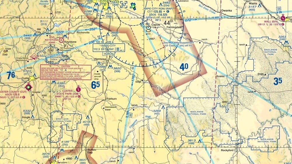
Did you know that there are highways in the sky that aircraft must follow when flying in controlled airspace? These “highways” are known as airways, and they play a vital role in ensuring safe and organized air travel. Let’s dive into the fascinating world of how runways are numbered and their significance in aviation.
When an aircraft is flying in controlled airspace, it doesn’t have the freedom to go anywhere it pleases. Instead, it must adhere to designated routes known as airways. These airways can be visual routes or instrument flight routes, depending on the type of flight. When operating under instrument flight rules (IFR), pilots follow established airways called “jet routes” or “Victor airways.” These airways resemble highways in the sky, guiding aircraft along specific paths between navigation points.
Jet routes or Victor airways, are a specific subset of airways designed for high-altitude, high-speed operations typically used by commercial jet aircraft. These routes often span long distances and connect major airports and metropolitan areas, allowing for efficient travel between regions. Jet routes are carefully planned to take advantage of prevailing winds, minimizing flight time and fuel consumption. Pilots navigating jet routes rely on advanced avionics and navigation systems to stay precisely on course, ensuring safe separation from other air traffic along these aerial highways.
In the United States, these airways are named with a combination of letters and numbers. For instance, an airway might be designated as “V123.” The letter “V” indicates that it’s a Victor airway, and the numbers represent the specific identifier for that airway. These numbers are carefully chosen based on factors such as geographic location and frequency separation to prevent confusion between different airways.
Both Victor Airways and Jet Routes play pivotal roles, each addressing specific types of flights. Victor Airways, often referred to as “VOR Airways,” serve as navigational corridors designed for smaller general aviation aircraft. Grounded in VOR navigation aids, they guide flights at lower altitudes and are particularly beneficial for regional journeys and visual flight rule (VFR) operations. On the other hand, Jet Routes, also known as “High-Level Airways,” are the highways of the sky for high-speed commercial jet aircraft. These routes, defined by waypoints and great circle paths, facilitate efficient long-distance travel at cruising altitudes, making them the preferred choice for instrument flight rule (IFR) flights. Together, these distinct airways ensure safe and organized travel across the skies, whether by smaller aircraft within the VOR Airways or by the swift jetliners cruising along the Jet Routes.
Aircraft navigation along these airways is facilitated by a variety of navigation aids, with the most advanced being the Global Positioning System (GPS). GPS technology allows pilots to pinpoint their exact location and follow airways with precision, similar to using a navigation app like “Waze” for the sky. Additionally, we have some traditional navigation aids like VOR (VHF Omnidirectional Range) and NDB (Non-Directional Beacon) providing accurate course guidance.
VOR provides pilots with reliable directional information by emitting signals that allow them to ascertain their radial position from the VOR station. This information proves invaluable in helping pilots maintain precise headings and stay on their intended course. Similarly, NDB is a radio beacon that broadcasts signals in all directions, enabling pilots to tune into an NDB frequency to determine their bearing relative to the beacon. While modern GPS technology has largely taken over navigation, VOR and NDB systems still find utility, particularly in areas where advanced infrastructure might be lacking. These aids continue to be used, albeit to a lesser extent, in regions where they offer valuable backup and redundancy options for navigation systems.
The utilization of VORs and NDBs persists in both the US and worldwide aviation landscapes. However, the FAA’s Navigation Programs Strategy, outlined in 2018, outlines a gradual phase-out plan for NDBs, including Locator Outer Markers, from the National Airspace System (NAS). Additionally, the strategy aims to optimize the network of VORs by streamlining it into a Minimum Operational Network, which involves the elimination of around 30% of the existing facilities. While VOR-based airways are predominant in the United States, NDB airways are more prevalent in other parts of the world, particularly in developing nations and sparsely populated regions of developed countries. Notably, NDBs offer extended range capabilities and operate at a lower operational cost compared to VORs, making them a preferred choice in certain contexts such as the Canadian Arctic.
Going back to Airways, they are especially important when flying at higher altitudes or through busy airspace. Think of them as the highways in the sky that keep air traffic organized and safe. Large commercial aircraft, when cruising at high altitudes, are often following these established airways, allowing for efficient and predictable routing.
However, airways are not limited to IFR operations. Visual Flight Rules (VFR) flights, typically used in uncontrolled airspace or areas with less air traffic, can also utilize designated routes. In the United States, these are known as “VFR corridors” or “Visual Reporting Points.” These routes help pilots navigate through complex airspace or around busy terminal areas while maintaining visual separation from other traffic.
Imagine looking up at the sky and seeing a smaller aircraft flying over a populated city. Chances are, that aircraft is following a specific route or corridor to ensure safe separation from other traffic and efficient navigation. Even though it might seem like they’re flying freely, they’re actually following predetermined paths that contribute to overall airspace safety.
So, the next time you gaze at the sky and spot an airplane, remember that it’s not just soaring aimlessly – it’s following the invisible highways of the sky. From GPS-guided routes to traditional navigation aids, these airways ensure that aviation remains a well-orchestrated symphony of flights, with each aircraft following its designated path through the vast expanse of the sky.
